Gamifying National Tourism Through Location-Based UX
Role
Product Designer
Type
0-to-1 Web Application & Design System
Scope
Product Strategy
Information Architecture
Interactive Map Engine
Gamification Flow Design
Problem
Portugal Play’s regional discovery platform struggled to drive engagement outside of major coastal hubs. Outdated travel directories, a fragmented ecosystem connecting local businesses, and a static interface made it difficult to capture the interest of modern travelers, leaving rich interior cultural assets completely overlooked.
Result
Visitor foot traffic expanded deeply into interior municipalities, driving measurable economic activity to independent local businesses. By shifting from traditional static listings to a gamified progression model, the platform eliminated early user drop-off and enabled regional merchants to scale their own promotional rewards autonomously.
Solution
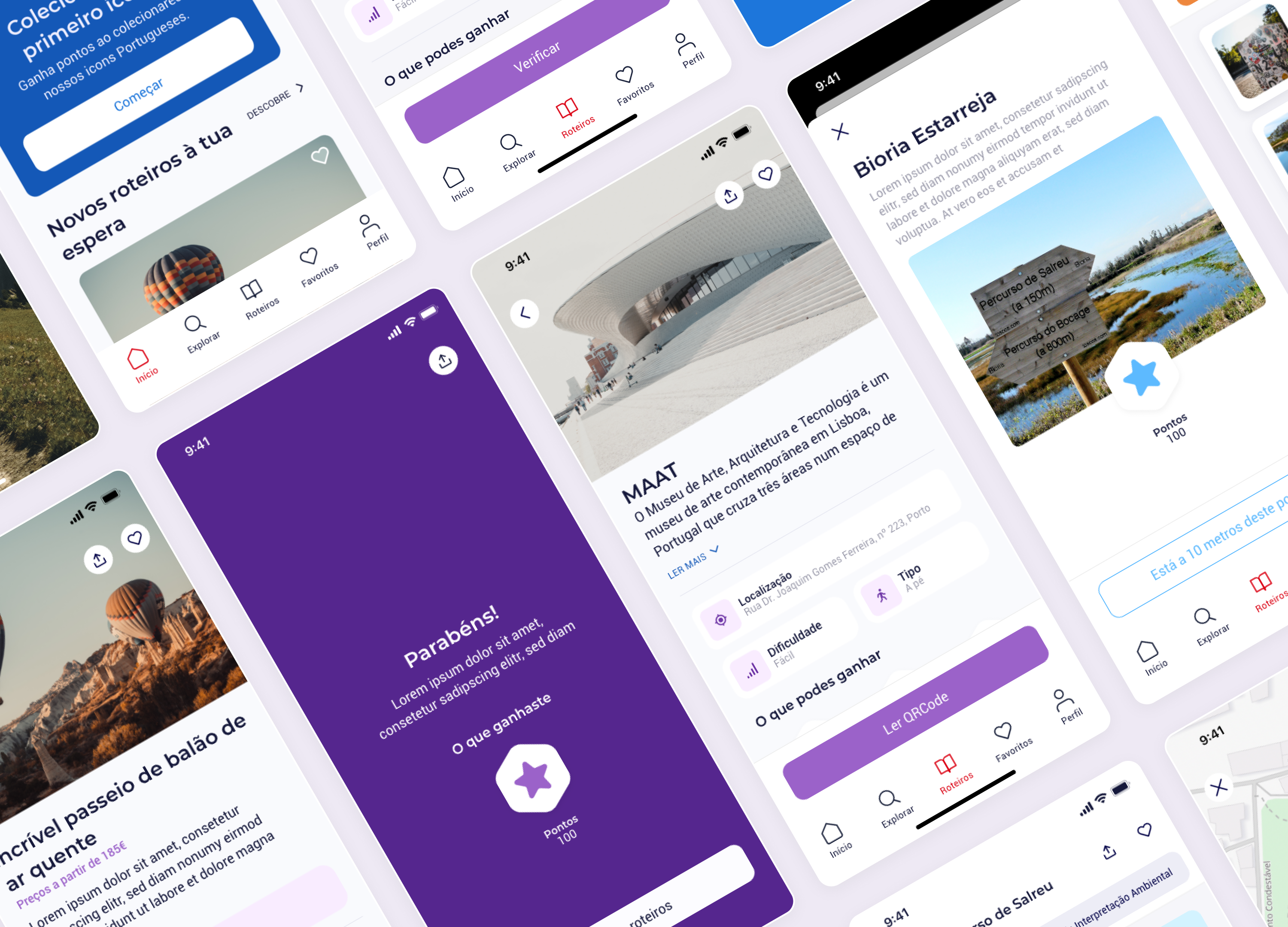
I designed an interactive "play-to-discover" mobile app that gamified regional exploration through localized challenges and routes. To support this, I developed a high-contrast visual system optimized for outdoor readability and integrated a contextual rewards dashboard linking digital checkpoints directly to real-world local business incentives.
The Complexities of Real-World Gamification
Portugal Play is an immersive mobile application that turns regional tourism and leisure into an interactive game. Utilizing location-based GPS data, augmented reality (AR), and 5G connectivity, the app guides users through regional road trips, historic routes, and local puzzles. As the Lead Product Designer, my primary hurdle was transforming dense, multi-layered real-world data—such as geographic locations, varying challenge scopes, constraints, and physical verification rules—into a clean, accessible interface suitable for users of all ages.
Simplifying Real-World Challenge Taxonomies
Designing a platform that pairs physical exploration with digital validation meant building an interface that can easily communicate diverse rule sets. The product handles a vast array of challenge variables: duration limitations, geographic scopes, physical check-ins, and distinct verification mechanics.
To prevent cognitive overload for families and older travelers, I developed a unified, highly scannable component schema. Every challenge card was stripped of superfluous text and organized around visual anchors.
I designed a system of custom iconography and a vibrant, meaning-driven color language. Different challenge types were assigned specific, high-contrast color codes and distinct icons. This approach allows users to immediately differentiate between an AR icon collection task, a historical riddle, or a multi-stop road trip route at a single glance.
The Multi-Step Interactive Map Engine
The structural hub of the Portugal Play experience is its native map navigation. Traditional map interfaces often struggle with multi-destination routes, overwhelming users with complex paths and overlapping location nodes.
I engineered a custom Multi-Step Interactive Map Engine optimized for cross-platform mobile environments. The layout groups real-time GPS positioning, active navigation progress, and upcoming geographic markers into a clean, bottom-anchored modal system.
The screen architecture scales intelligently based on user behavior:
- Default Map View: Offers a wide-angle perspective focusing on nearby point-of-interest clusters and regional paths.
- Active Exploration View: Automatically isolates the current segment of a route, updating live progress indicators while leaving maximum screen real estate for ambient map interaction.
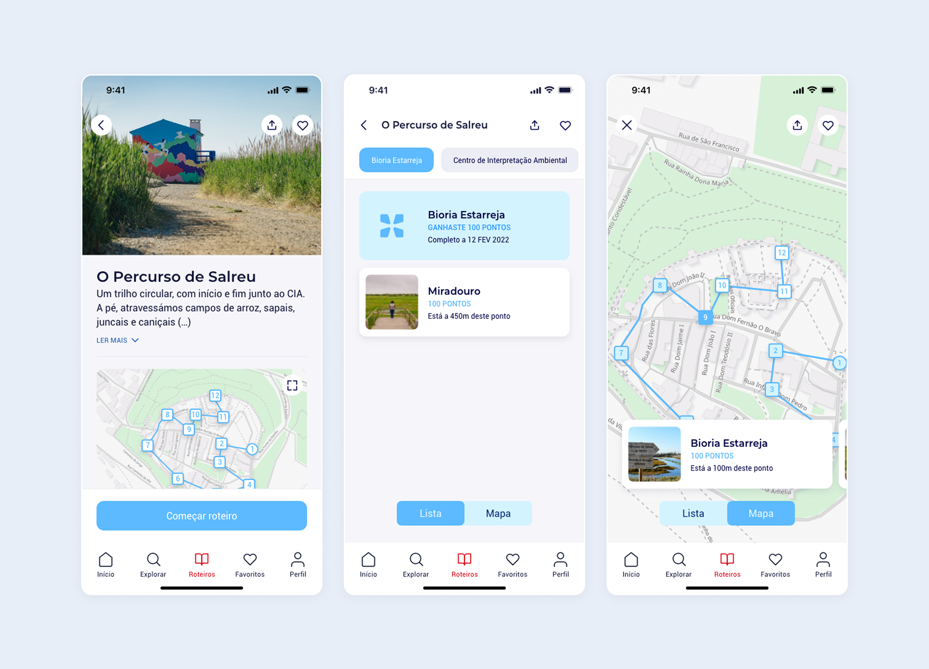
Structuring Frictionless Verification Loops
Because completing puzzles translates directly into real-world points, rewards, and local discounts, the verification loop had to be ironclad yet completely frictionless. If a user struggles to check into a physical landmark like the Castelo de Bragança, the gamification loop breaks.
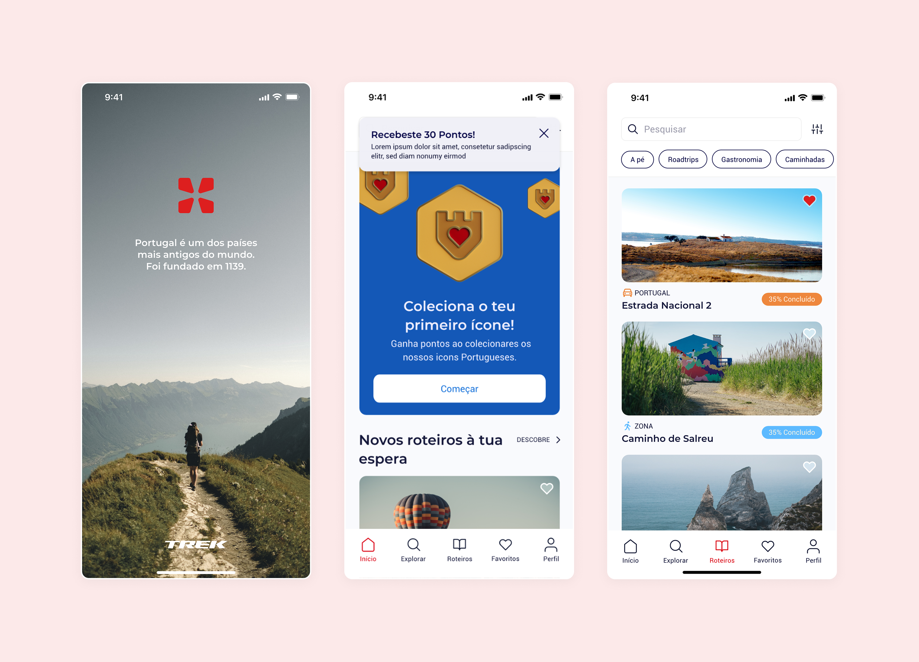
I mapped out an intuitive 3-step action flow that handles varying device capabilities gracefully. When a user arrives at a target coordinate, the map screen transitions via a subtle micro-interaction into an immersive verification overlay.
If the task requires AR validation, the interface opens a clean camera viewport featuring minimalist, highly visible digital bounding boxes that assist the user in framing and capturing 3D national icons. If device hardware or data speeds lag, the UI smoothly offers a fallback verification route, protecting the core game loop across both high-end and entry-level devices.
Universal Design Systems for All Demographics
To ensure production fidelity across both the iOS and Android tracks, I built a cohesive, multi-platform component library from scratch. The aesthetic language leans heavily into a clean, minimal, light-mode-first framework to guarantee optimal sunlight readability during outdoor exploration.
Every component was rigorously checked for touch-target safety, ensuring an accessible experience for young children and older adults alike. I documented comprehensive interactive states, loading loops, and map transition prototypes. This detailed handoff structure provided the engineering teams with a clear development roadmap, accelerating cross-platform launch timelines.

Driving National Exploration and Scale
By replacing complex text strings with a highly visual, structured color-and-icon taxonomy, Portugal Play successfully bridged the gap between complex digital tools and real-world physical exploration. The intuitive multi-step map engine and accessible layout system eliminated user drop-off during outdoor challenges. This design architecture allowed the platform to launch simultaneously on the Google Play Store and iOS App Store with total visual alignment, transforming regional tourism into a scannable, engaging, and universally accessible game.